

(NEW YORK) — The biggest snowstorm of the season ended in the Sierra Nevada mountains of California overnight, but more snow is on the way for some.
Some of the highest snowfall totals so far are more than 7 feet.
The highest wind gusts in the mountain peaks were above 190 miles per hour, while lower elevations had gusts 50 to 100 mph.
As of early Monday, Interstate 80 remained closed in California due to the massive blizzard.
There were also two reported tornadoes in California, north of Fresno, over the weekend.
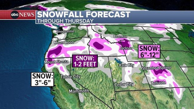
A new snowstorm is expected to hit the West Coast on Monday night into Tuesday but further north this time, mostly over Mount Shasta in the Cascade Range in far northern California and into parts of Oregon and Washington.
Lake Tahoe and the hard-hit I-80 could get grazed by the southern edge of this new storm, with an additional 6 to 18 inches of snow possible.
The region is under a winter storm warning until Tuesday night.
Copyright © 2024, ABC Audio. All rights reserved.