• Cold Weather Advisory - Click for Details
    ...COLD WEATHER ADVISORY REMAINS IN EFFECT UNTIL NOON CST TODAY...
    Expires: January 19, 2026 @ 12:00pm
    WHAT
    Very cold wind chills as low as 20 to 30 below.
    WHERE
    Portions of north central and northwest Illinois and east central and southeast Iowa.
    WHEN
    Until noon CST today.
    IMPACTS
    The dangerously cold wind chills as low as 30 below zero could cause frostbite on exposed skin in as little as 30 minutes. Frostbite and hypothermia will occur if unprotected skin is exposed to these temperatures.
    PRECAUTIONARY/PREPAREDNESS ACTIONS
    Wear appropriate clothing, a hat, and gloves. Keep pets indoors as much as possible. Make frequent checks on older family, friends, and neighbors. Ensure portable heaters are used correctly. Do not use generators or grills inside.

Loading advertisement…

Fire Weather Watch for Monday, February 26, 2024

SHARE NOW

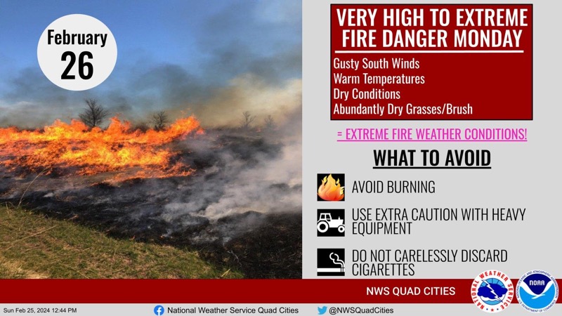
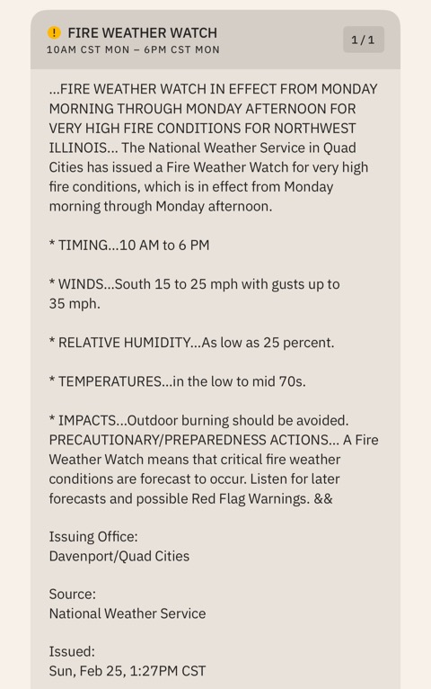
The National Weather Service in the Quad Cities has issued a Fire Weather Watch for Monday, February 26, 2024, from 10 AM to 6 PM. Relative Humidity of 25% and south winds 15-25 mph with guts up to 35 mph are forecasted. A Fire Weather Watch means that critical fire weather conditions are forecast for the area.

“Dry air, warm temperatures, abundant dry grasses, and gusty south winds will produce prime conditions for wildfire growth Monday. Please use extra caution if planning on working outdoors. Please DO NOT carelessly discard cigarettes. Any spark could cause a fire.”


Submit a Comment