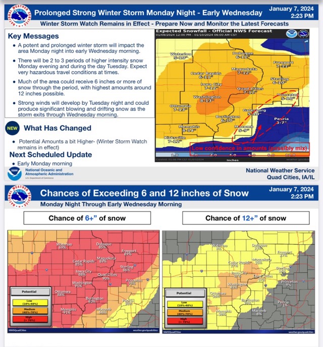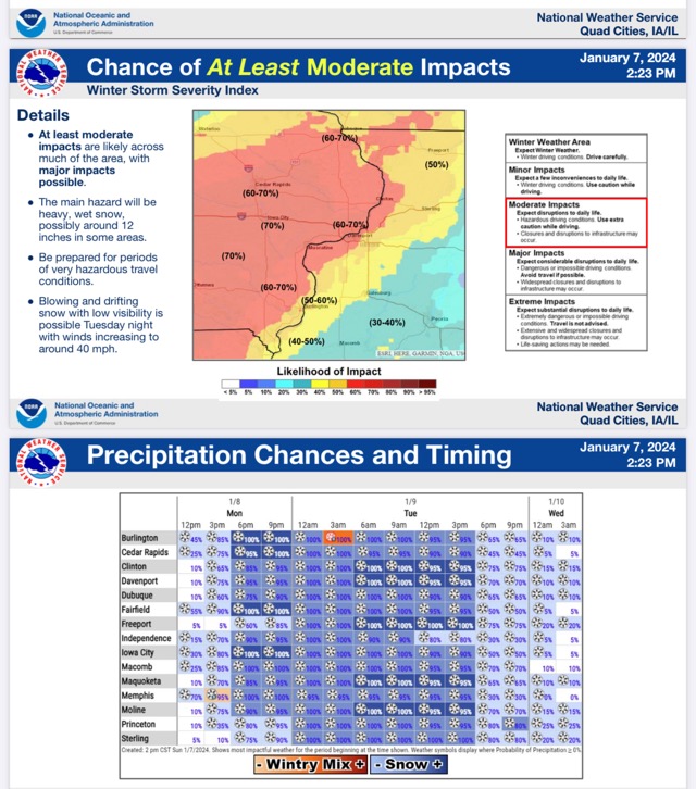
The National Weather Service has issued a Winter Storm Watch for much of central Illinois from Monday night through early Wednesday morning. Moderate to heavy snow will travel through our area from southwest to northeast by Monday evening and then shift west to east by early Wednesday morning. Total snow accumulations of 7 to 12 inches are likely. Winds could gust as high as 40 mph Tuesday afternoon and Tuesday night leading to considerable blowing and drifting snow creating dangerous driving conditions on Monday and Tuesday night into Wednesday morning. Portions of north central, northwest and west central Illinois, east central, northeast and southeast Iowa, and northeast Missouri are in the warning area. This storm is expected to be a long-duration snow event with two to three periods of heavy snow is expected. Amounts up to a foot of snow are likely. Bureau, Carroll, Hancock, Henderson, Henry, Jo Daviess, McDonough, Mercer, Putnam, Rock Island, Stephenson, Warren, and Whiteside Counties are in this watch area.
Total snow accumulations of 5 to 9 inches and possible for portions of central and west central Illinois from Monday evening through late Tuesday night. Winds gusting up to 40 mph Tuesday night into Wednesday morning leading to blowing and drifting snow. Cass, Fulton, Knox, Marshall, Mason, Menard, Morgan, Peoria, Schuyler, Scott, Stark, Tazewell, and Woodford counties are in this watch area.