


****Updates added below***
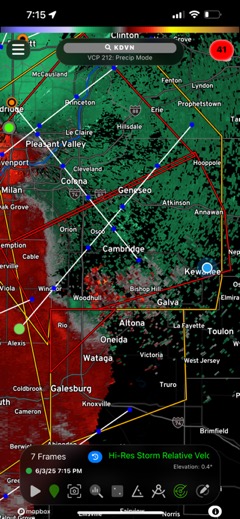
Three active Tornado Warnings affecting most of our area from the Missouri border into the Quad Cities area, including Henry County. Mercer, Knox, and Henry Counties. The line of storms from Blue Grass, Iowa, to south of Monmouth are tracking northeast. Only a small section of Henry County is included in this current warning, but the area could be extended if the storms hold their strength. Knox County down to Galesburg was the most recent addition to the warnings. The strongest point according to radar is from Alexis to west of Galesburg. These warnings are radar indicated and no tornadoes have been reported. Strong winds and spin-up tornadoes are possible with these storms.
New Tornado Warnings affecting most 7:08 PM – includes the are of Buffalo and Preemption into Whiteside County to Erie. This includes Coloma and just west of Geneseo. Coyne Center should take shelter immediately. Radar indicates rotation has strengthened and is near Coyne Center.
New Tornado Warnings affecting for Henry County at 7:15 PM and includes all of Henry County to Hoopole and Neponset. Part of Bureau County included in the tornado warnings
Broad circulation between Alpha and Cambridge at 7:29 PM. Storm track shows it crossing Highway 81 towards Highway 6 in Atkinson.
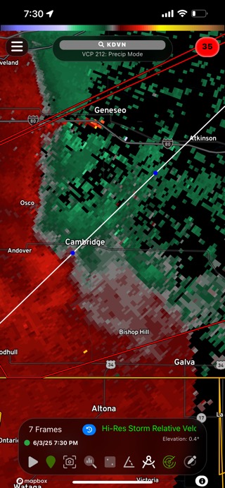
Colona could see very strong winds any minute.
7:35 PM – The storms are headed towards Kewanee and Annawan. The echo is headed at Annawan.
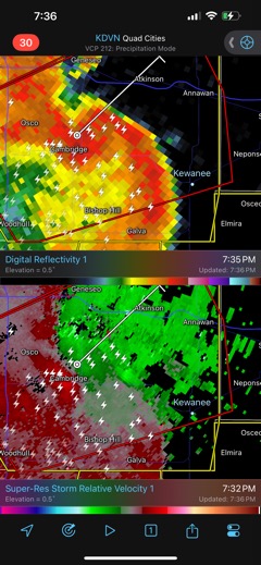
Slight rotation continues from Cambridge towards Atkinson. New rotation southwest of Atkinson just south of I-80.
7:52 PM – minor rotation still near Atkinson and Annawan.