

The freezing rain shifted south to include most of Henry County today. Temperatures are expected to rise above freezing this afternoon and melt the ice. Scanner traffic was very busy throughout the night and Saturday with accidents. Caution is advised if you must travel. You can check road conditions at this link: https://www.gettingaroundillinois.com/winterconditions/. The Stark County Sheriff’s Office said in a Facebook post that roads are freezing over and to allow enough travel time, if travel is necessary. The Bureau County Emergency Management Agency said on Facebook that roads are becoming slick across the county and to allow extra time for travel.
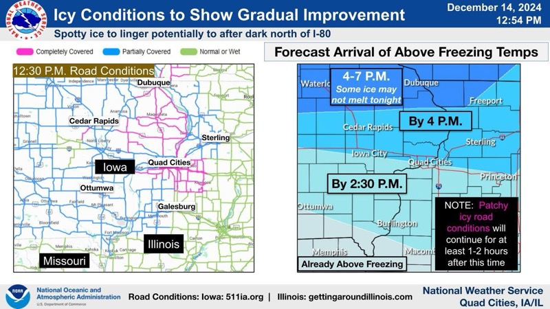
[12:55 P.M. Saturday, December 14, 2024]According to the NWS of the Quad Cities, “A look at road conditions as reported by DOTs show partially to completely ice covered in most locations, but a slow improving trend from south to north. That improvement is tied to temperatures warming, and shown is the forecast arrival time of above freezing temperatures. Note there will be residual patchy icy roads lasting beyond that time.”