7:32 Update: I-74 southbound closed for unknown reasons according to WQAD. This is possibly related to a crash from earlier.
Toulon had around 100 reported without power
7:24 PM: Gust front hitting Kewanee.
7:08 Update: Tornado warning for part of Knox County and Stark County, headed northeast from Oneida. Victoria and Toulon are in the path.
7:06 Update: Tornado warning for confirmed tornado near Carthage. Headed northeast
6:48 Update: Tornado warning for Knox County west of Galesburg.
6:43 Update:A severe thunderstorm warning has been issued for the rest of Henry County for 70 mph winds.
6:39 Update: Severe thunderstorm warning for northern Henry County and Whiteside County.
6:37 Update: Radar indicated broad rotation near Alexis. The storm is headed Northeast towards Geneseo. Woodhull and Cambridge be alert.
6:34 Update: A gust front with strong winds is headed east towards Henry and Whiteside Counties. Another gust front is headed toward Knox County
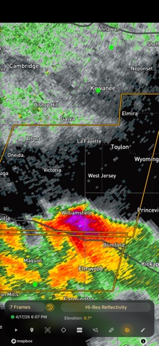
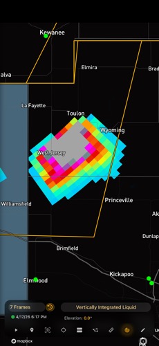
6:24 PM Update: Severe storm with large hail near Toulon. Knox Counry is reporting power outages.
6:18 Update: severe storm with large hail right over Highway 78. Headed towards Toulon and Bureau County. Storm winds and golfball size hail are possible.
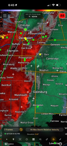
6:12 Update: Severe storm with 70+ mph winds headed east from Eldridge Iowa towards Rock Island and Henry Counties. A wQAD storm chaser captured a 91 mph wind with this storm.
6:10 Update: There is a tornado warning for radar indicated rotation near Morning Sun headed east towards Mercer and Henry Counties. 6:15 update: tornado warning has been called.
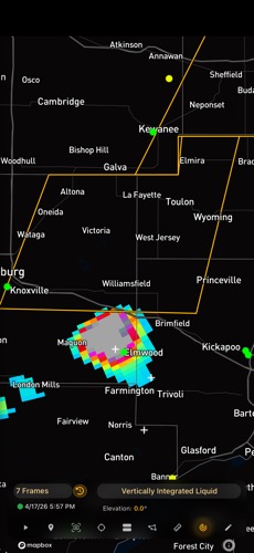
There is a severe storm with large hail in Knox County headed north towards Stark and Henry Counties.